B-Walking: Rosedale Rendezvous
Our three expeditions this week (Sunday, 5th September) each took place in the Rosedale area of the North York Moors. The A-Walk set off from Brown Hill, the B-Walk started at Castleton and the C-Walk commenced at Castleton Rigg. All three walks finished at Rosedale Abbey.
After leaving Castleton {NZ 685 080}, the intent of the B-Walk was to visit Holly Lodge Farm, Stormy Hall, Honey Bee Nest, White Cross, Farndale Moor (dismantled railway line), Blakey Ridge and Thorgill before arriving at our final destination in Rosedale Abbey {SE 724 959}.
We left our drop-off point at about 10.40 am. There were sixteen people in the group. PB led the walk.

From our starting location in front of the primary school in Castleton, we followed a public footpath in a southerly direction to a path junction at {NZ 686 076}. Turning onto a south-westerly bearing, we passed by Didderhowe Farm {NZ 684 075} (on our right). We now navigated a route to the farm access track near Forest Farm {NZ 683 070}.
Continuing on our southerly trek through Danby Dale, we passed by Holly Lodge Farm {NZ 686 064} and Plum Tree Farm {NZ 689 054} in order to reach the minor road at Stormy Hall {NZ 688 044}. Maintaining our southerly bearing we made our way to Honey Bee Nest {NZ 688 034} where we turned onto a westerly bearing in order to start the major climb of the day.
Just after leaving Honey Bee Nest, we decided to stop for a short lunch break at {NZ 687 034} - in order to take advantage of the dry stone walls to shelter from the wind.
After our lunch break we continued our climb out of Danby Dale - making our way on a westerly bearing to a minor road at {NZ 682 029}. Turning left, a little further up the road we picked up a south-going track that took us over the moor to reach the minor road at {NZ 682 019} near White Cross.

After crossing the road, we followed a path in a south-westerly direction across the moorland that makes up Rosedale Head. This took us to the Castleton road at {NZ 675 012} near to the large boundary stone.
Continuing on our south-westerly bearing, we crossed the moorland terrain to reach the dismantled railway line on Farndale Moor at {NZ 656 005}. Turning left along the track, we followed this in a south-easterly direction to reach the road junction at {SE 683 989} on Blakey Ridge - just south of The Lion Inn.
From the car park near the road junction, we started our descent into Rosedale - stopping near {SE 689 988} (just above Moorlands Farm) for a very pleasant tea stop.
On leaving the tea stop location, we followed the farm track downhill to Moorlands Farm. Just after passing trough the farm, we turned right onto a good track (Daleside Road) at {SE 692 988}. This took us in a southerly direction along the west side of Rosedale to Thorgill {SE 707 966}.

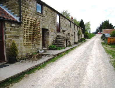
Just after passing the cottages in Thorgill, we turned left onto a public footpath that took us downhill to a footbridge at {SE 710 967}. We used this to cross the stream and then turned back onto a southerly bearing. We now followed the track on the east side of the River Seven to reach Rosedale Abbey {SE 724 959}.

Although our walks today each started off from different locations, they showed a great deal of similarity in their latter stages. This meant that we were able to rendezvous successfully on the approach to, or at, Rosedale Abbey.
Use the buttons below to see where we went, how we did and some of the photos.
Labels: B-Walking: Rosedale Rendezvous


0 Comments:
Post a Comment
Subscribe to Post Comments [Atom]
<< Home