Wednesday 29 April 2009

Dufton Delights

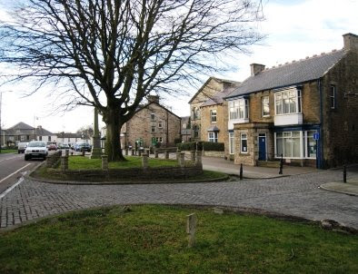
As I was unable to get to the Lake District on 26th April, I decided to go on a ‘photo-shoot’ expedition and, at the same time, do a little pre-walk checking in the Dufton {NY 688 251} area of Cumbria. I set off from Middlesbrough at about 10.45 am and drove the 63 miles to arrive at Dufton at about 12.15 pm. When I got there, would you believe, the car park was full to capacity! Fortunately, I managed to find a parking spot at the far (west) end of the village (see picture below).

Village Green at Dufton
I set off from the village in a south-westerly direction along the minor road leading to Keisley - with good views of Murton Pike in the distance. I continued along the road to High Cup House {NY 718 232} - where I left the road. Here, I turned left onto a north-easterly bearing and followed a good (initially) farm track from Harbour Flatt towards Middletongue Crag. I climbed up to the base of the crag and then followed the contour lines around into High Cup Gill in the direction of High Cup Nick - trying not to loose any height.

I kept (more or less) to the route of the public footpath until I reached the point {NY 741 255} where I decided to implement an amendment to my originally planned route. I was originally going to do the climb out of the valley at High Cup Nick itself - but thought I might get some good photos as a result of my route amendment.

So, my new climb-plan was to take me up onto High Cup Scar near {NY 743 254}. I had to choose my route very carefully so as to avoid any confrontations with vertical rock faces - which I would not be able to climb. I therefore decided to make my ascent from {NY 741 255} in the direction of Murton Fell to reach the point {NY 743 254}. The yellow line in the picture below shows my ascent path.

Ascent Route - High Cup Scar
This was indeed quite a climb - in some places, almost vertical! However, it was well worth it in terms of the lovely photo-shots that I was able to get. As I neared the top of my ascent I had to carefully choose my route through the scar to avoid the (famous) vertical rock formations both to the left and to the right of where I was heading.

Once I was up on top of the scar I walked in a northerly direction along its edge (taking photographs as I went) in order to reach High Cupgill Head. From here I followed the route of the Pennine Way (PW) in an easterly direction to reach {NY 555 267} and then turned onto a north-westerly bearing in order to get to the footbridge at Maizebeck Scar {NY 749 270}. From here I went back to High Cup Nick to take more photographs. By now the wind was blowing hard and it was difficult to keep the camera still!

From High Cup Nick I moved off in a north-westerly bearing to rejoin the PW which I followed (downhill) back to Dufton.

What a tremendous day I had; good weather, beautiful scenery and a terrific climb! Use the buttons below to see where I went, how I did and a small selection of the photos that I took.


Labels:

Mid-Week Walking from Castle Eden

On Wednesday, 6th May, Stockton Rambling Club have a mid-week walk in the Castle Eden area of County Durham. Please meet at 7.00 pm at the Castle Eden Inn {NZ 424 375} - see the following map. Park opposite the pub.

Map of the Castle Eden area
The walk will not be longer than 6 miles.
For further details ring 01740-644347.


Labels:

Tuesday 28 April 2009

Sunday Walking in Weardale

On Sunday, 3rd May, the Stockton Rambling Club will have three walks in the Weardale area of County Durham. All walks will finish in Allenheads {NY 860 453} - see the following map.

Map of the Daddry Shield to Allenheads areaCopyright Notice
The A-walk will start at Daddry Shield {NY 894 379} and will take in Cowshill, Wellhope, Kilhope Bridge and Byerhope.

The B-walk will also commence at Daddry Shield and will visit Wearhead, High Rush, Wellhope and Viewly Hall.

The C-walk will set off from Rookhope Road {NY 869 453} and will pass through Peasmeadows, Hopehead and Hammer Shields.

This is a Route 3 coach pick (Acklam: 9.30 am, Stockton: 9.45 am and Billingham: 10.00 am).


Labels:

Thursday 23 April 2009

A-Walking: Teesdale Totters

Our expedition today (19-12-2009) took the form of a circular trek setting off from Middleton-in-Teesdale {NY 947 253}. Our route took us west along the Pennine Way and then north to Holwick Scars - returning east over Coldberry and then south along Hudeshope Beck back to Middleton.

We set off from the town square (see picture below) at about 11.00 am. There were 8 people in the group: JB, PB. KF, CH, MS, MuS, JY and PY. PB led the walk.

Town Centre - Middleton-in-Teesdale
Following the B6277 road south, we crossed the River Tees at {NY 947 253} and then 'picked up' the Pennine Way (PW). We followed this in a south-westerly direction. This took us up onto Harter Fell - the first major climb of the day. Leaving the PW at {NY 925 233} we turned onto a north-westerly bearing and headed for Brown Dod and onwards to Crooks o' Green Fell. Turning north, we then headed for Holwick Scars {NY 900 270}.

From Holwick Lodge {NY 902 276} we headed in a north-westerly direction in order to cross the River Tees using the footbridge at {NY 889 283}. Once we were over the river, we headed for Bowlees {NY 906 282}; we went via Ash Hill {NY 894 289} in order to minimise the amount of road walking that we had to do!

Our route from Bowlees took us north (passing Gibson's Cave on our right) to Broadley's Gate {NY 908 298} where we now turned onto an easterly bearing. This took us across to Coldberry {NY 934 296} (and the second major climb of the day). Leaving the high ground, we now descended down to Hudeshope Beck {NY 946 292}.

Turning onto a southerly bearing, we followed the course of the beck in order to reach Skears {NY 948 279} and, further south, Snaisgill Plantation {NY 953 270}. From here I had intended to 'circle' around to take in Stanhope Gate {NY 955 257} (in order to avoid road walking) before arriving at our final destination. However, because we were 'running late' we had to give this a miss and continue down the road to reach Middleton.

Click the buttons below to see the GPS tracklog, the walk statistics, commendations, mistakes and, of course, the photos.


We had some tremendous weather today and experienced some wonderful sights. Undoubtedly, we saw Teesdale at its best.


Labels:

Wednesday 22 April 2009

Two Mid-Week Walks from Clay Bank

During the week beginning 27th April, Stockton Rambling Club will have TWO mid-week walks available. One is an evening walk and the other is a day walk.


The evening walk is on Wednesday, 29th April and will start at 7.00 pm from Clay Bank car park {NZ 572 035} - see the picture and map below.

Photograph of Clay Bank car park.
This walk will not be longer than 6 miles.
Please ring 01740-644347 for more details.


The day walk is on Thursday, 30th April. It will start at 10.30 am from Clay Bank car park {NZ 572 035} - see the map below.

Map of the Clay Bank Car Parking Area
The length of this walk will be up to 10 miles.
Please telephone 01642-320428 for more details.


Labels:

Monday 20 April 2009

Sunday Walking: Lakes Day in Ullswater

On Sunday, 26th April, the Stockton Rambling Club will have three walks in the Ullswater area of the Lake District. All walks will start at Pooley Bridge {NY 470 244} and finish at Glenridding {NY 386 171} - see the following map.

Map of the Ullswater area
The A-walk will take in High Street, High Raise and Angle Tarn. This walk will involve 2800 ft of ascent.

The B-walk will visit Mellguards, Martindale and Place Fell. This walk will involve 2500 ft of ascent.

The C-walk will follow the lakeside path and pass through Howtown and Sandwick. This walk will involve 1100 ft of ascent.

The cost of this trip is £8-00 and advanced booking is necessary. Further details and bookings: 01642-350504.

This is a Route 2 coach pick up and is also an early start (Billingham: 8.30 am, Acklam: 8.45 am and Stockton: 9.00 am).


Labels:

Thursday 16 April 2009

Mid-Week Walking from Longnewton

On Wednesday, 22nd April, Stockton Rambling Club will have a mid-week walk in the Longnewton area of Stockton-on-Tees. Please meet at 7.00 pm at the Londonderry Arms, Darlington Road, Longnewton {NZ 383 165} - see the following map.

Map of the Longnewton area
The walk will not be longer than 6 miles.
For further details ring 01642-880261.


Labels:

Tuesday 14 April 2009

A-Walking: Castleton Capers

Our route today (12-04-2009) took us from Castleton {GR NZ 681 077} via Dale View {NZ 666 070}, Baysdale Moor {NZ 629 046}, Burton Howe {NZ 608 032} and Battersby Junction {NZ 588 072} to Great Ayton {NZ 562 107}.

We set off from the car park at High Castleton at about 10.45 am. There were eight peoplein the group: PB, RB, KF, CH, MH, MS, MuS and GT. CH and MH led the walk.

We left Castleton on a south-westerly bearing - passing the boundary stones on our left (see picture below). We descended to the River Esk, which we crossed using a footbridge just to the south of Dibble Bridge Farm.

Boundary Stones near High Castleton Car Park
From here we took a south-westerly path up onto Westerdale Moor. Continuing in a westerly direction, we crossed Little Hograh Moor and Great Hograh Moor to reach Holiday Hill {NZ 632 065} where we turned onto a southerly bearing. This took us over Baysdale Moor to Armouth Wath {NZ 620 034} where we had a delightful lunch break.

After lunch, we followed an uphill track to Burton Howe where we joined the Cleveland Way (CW) at {NZ 607 032}. Because the weather conditions were so good, we had some tremendous views from the CW as we headed north. We left the CW at NZ 601 050 (still following our northerly bearing) and descended from the high ground at Ingleby Bank to reach Bank Foot {NZ 592 061}.

We continued on our northerly trek to Battersby and then turned left to reach the railway track which we followed (across the fields) to Battersby Junction railway station {NZ 588 072} - where we posed for photographs. Continuing on a north-westerly bearing, we now had an 'easy' walk to Easby {NZ 577 088}; we stopped for a very pleasant 'tea stop' beside the River Leven at {NZ 574 094}. Following a peaceful few minutes beside the river, we set off again, now heading for Little Ayton {NZ 569 101} and our final destination (see picture below).

Captain Cook's Statue in Great Ayton
Many thanks to Cliff and Martin for a splendid walk and a great day out.

Click the buttons below to see the GPS tracklog, the walk statistics and, of course, the photos.


Labels:

Monday 13 April 2009

Sunday Walking - Middleton-in-Teesdale

On Sunday, 19th April, the Stockton Rambling Club will have three walks in the Teesdale area of County Durham. All walks will start and finish in Middleton-in-Teesdale {NY 947 254} - see the following map.

Map of the Middleton-in-Teesdale area
The A-walk will take in a section of the Pennine Way, Holwick, Coldberry and Hudeshope.

The B-walk will visit Great Eggleshope Beck and Foggerthwaite.

The C-walk will pass through Bowlees and Gibson's Cave.

This is a Route 2 coach pick up (Billingham: 9.30 am, Acklam: 9.45 am and Stockton: 10.00 am).


Labels:

Wednesday 8 April 2009

A-Walking: Bridestones Revisited

It has been some time since we last walked in the Stain Dale and Bridestones area. So, this expedition was a source of many good memories of previous walks through this delightful locality.

We set off from Eller Beck Bridge {SE 858 982} (on the A169 road to Pickering) at about 10.50 am. There were 8 people in the group: JB, PB, KF, MS, MuS, GT, JY and PY. PB led the walk.

Eller Beck Bridge
After crossing the North York Moors railway line, we headed west along the route of the Lyke Wake Walk to reach Simon Howe {SE 830 981}. We now turned left and headed south to Wardle Green {SE 824 962}.

Continuing on our southerly trek we passed through Wethead {SE 812 926} and Newton Banks {SE 814 909} in order to arrive at Farwath {SE 829 883}. From here we had a good climb up through Cross Dale to reach the Fox and Rabbit Farm {SE 845 882}. We now dropped down into Stain Dale {SE 869 903}and followed a north-easterly path to reach the impressive Bridestones area {SE 874 913}. The picture below shows "The Pepperpot" in Low Bride Stones.

Bridestones area
Going north through Dove Dale (on the western edge of Dalby Forest), we followed an up-hill path to Needle Point and meandered through the impressive collection of rock formations and then headed north towards Newgate Brow. Now we turned left and followed a good track (Old Wife's Way) in a westerly direction in order to make our way to the car park at the Hole of Horcum {SE 852 936} - where our expedition terminated.

Click the yellow button below in order to see the GPS tracklog of where we went and how we did. Click the cyan button to see some of the photographs that we took.


Labels:

Tuesday 7 April 2009

Three Mid-Week Events From SRC

During the week beginning 13th April, Stockton Rambling Club will have THREE mid-week events on offer. The first is a day walk, the second is an evening walk and the third is a guided tour of Durham Cathedral (with an optional walk).


The day walk is on Wednesday, 15th April and will start at 10.30 am from Yarm Bridge {NZ 418 132} - see the map below.

Map of Yarm Bridge area.
This walk will not be longer than 5 miles.
Please ring 01642-769579 for more details.


The evening walk is also on Wednesday, 15th April. It will start at 7.00 pm from The Blue Bell (near Yarm Bridge) - see the above map and the picture below.

Photo of the Blue Bell Inn.
The length of this walk will be up to 6 miles.
Please telephone 01642-780538 for more details.


The visit to Durham Cathedral is on Thursday, 16th April. The cost of the guided tour is £6-00 (£5.00 conc.). Further details can be obtained from Bill (and bookings made) by ringing 01740-644347.

Durham Castle & Cathedral
This trip to Durham also includes an optional walk, the length of which will not exceed 6 miles.


Labels:

Monday 6 April 2009

Sunday Walking to Great Ayton

On Sunday, 12th April, the Stockton Rambling Club will have three walks in the North-Western area of the North York Moors. All walks will finish in Great Ayton {NZ 562 107} - see the following map.

Map of the Castleton - Great Ayton area
The A-walk will start at Castleton {NZ 687 081} and will take in Dale View, Baysdale Moor, Incline Top and Battersby Junction.

The B-walk will also commence at Castleton and will visit Dale View, Kildale, Captain Cook's Monument and Aireyholme Farm.

The C-walk will set off from Birk Brow {NZ 659 148} and will pass along the Quaker's Causeway and will then take in Westworth Wood and Aireyholme Farm.

This is a Route 1 coach pick up (Billingham: 9.30 am, Stockton: 9.45 am and Acklam: 10.00 am).


Labels:

Thursday 2 April 2009

A-Walking: Our Weardale Wander

We set off from a lay-by on the B6278 road near Stanhope Bridge {NY 986 391} at about 11.00 am. There were eight of us in the group: PB, RB, KF, CH, JJ, PY, JY and Rob. PB led the walk.

After crosing the River Wear (see picture below) we turned right along a narrow minor road that took us to Aller Gill Cottage {NY 977 384}. Here we turned left off the road and walked up-hill through the farm.

River Wear at Stanhope Bridge.
We continued up-hill in a southerly direction to reach Newlandside Farm {NY 976 376} where we turned right onto a south-westerly bearing. We then followed a zig-zag path uphill to reach Round Hill {NY 977 367} and then Carrs Top {NY 961 355}. From here we had an arduous trek over the peat hags in order to reach Snowhope Hill and then to Outberry Plain where we turned east - following the boundary fence.

As we were now at the highest point of our route (2126 feet), there was quite a cold wind blowing - very different from our starting point back in Stanhope. There was now lots of snow, ice and cold water under foot. As it was now well after 13.00 hrs, most people were wanting their lunch! As there was no obvious cover anywhere to be seen, we decided to 'huddle-down' in one of the peat hags at {NY 945 333} for our lunch stop.

After lunch we continued our 'battle' over the peat hags - moving in an easterly direction to reach the trig-point on Harnisha Hill near Raven Seat. We continued to loose height as we passed Three Laws and descended to the B6278 road at {NY 992 318}. Now we had a gentle climb up to the currick on Long Man.

We continued on to Pawlaw Pike {NZ 007 322} and then took a north-easterley bearing (passing Five Pikes {NZ 013 329} on our left) to reach the point {NZ 036 341} where we had to leave the high ground in order to descend to Frosterley. We could see the town way below us in the distance on our left.

We dropped down to Allotment House {NZ 031 343} and then followed the minor road in a northerly direction to White Kirkley. Just after here, at {NZ 025 360}, we had to make a diversion from the originally planned route because the footbridge at {NZ 030 367} over the River Wear into Frosterley was in need of repair (see picture below).

Bridge over River Wear at Frosterley
Bearing in mind the state of the above bridge, we re-routed along the minor road from Low Bishopley in order to cross the river at Frosterley Bridge {NZ 023 369} to reach our coach which was parked on the A689 road at {NZ 024 370}.

Despite the conditions under foot and the very variable weather conditions that we encountered, we had a great day. Click the button below to see the GPS tracklog of where we went and the walk statistics.


Click the button below in order to see a selection of the photographs that were
taken during our Weardale expedition:


A major route amendment had to be made during the execution of the walk plan, click the button below to see an analysis of this:


Labels: