Wednesday 31 March 2010

A-Walking: Whitby Westward Wander

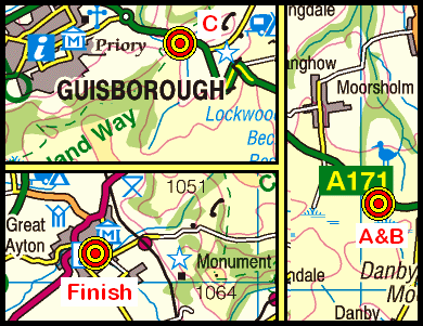
Our three walks this week (28th March) were based in the eastern region of the North York Moors. The A-Walk set off from Whitby; the B-Walk started at Aislaby; and the C-Walk commenced at Barton Howle. All three walks finished in Egton Bridge {NZ 804 052}.

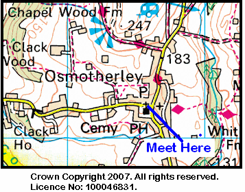
After leaving Whitby {NZ 886 103}, the intent of the A-Walk was to visit Sneatonthorpe, New May Beck, Old May Beck, Arundel Hill, Beck Hole and Dowson Garth before arriving at our final destination in Egton Bridge.

We left our drop-off point on the A171 road {NZ 885 102} at about 11.50 am. There were 6 people in the group: JB, JPB, LB, PB, LM and KF. PB led the walk.

Leaving the B1416 road at {NZ 886 103}, we made our way on a north-easterly bearing towards the dis-used railway track at {NZ 893 107}. Turning right, we followed this in a southerly direction in order to reach a walkway that took us over the River Esk by means of the (now dis-used) railway viaduct at {NZ 896 097}.

Railway viaduct
We left the walkway at {NZ 896 095} and navigated a route through the woods at {NZ 898 091} in order to reach Golden Grove {NZ 900 088}. From here we made our way in a southerly direction across the fields to Bennison House Farm {NZ 902 080} and then Mortar Pit Farm {NZ 904 068}. Turning left onto a minor road at {NZ 903 068}, we followed this in a south-easterly direction to Sneatonthorpe {NZ 907 061}.

Changing back to a southerly bearing, we now followed Raike's Lane towards Soulsgrave Farm {NZ 901 044} in order to reach the B1416 road at {NZ 901 041} near Sneaton Low Moor. Crossing the moor, we arrived at a minor road near New May Beck at {NZ 897 034}. We followed the road in a southerly direction and descended from the high-ground to reach the car park at May Beck {NZ 892 024}. We decided to stop here for our lunch stop - sitting on the rocks overlooking the river.

Lunch stop
We left the car park by following a track at {NZ 892 024}. This took us in a north-north-westerly direction through the woods to Old May Beck {NZ 891 028}. Changing to a north-westerly bearing, we now followed a good track to Foss Farm {NZ 885 031} and then, after crossing Parsley Beck, we arrived at Leas Head Farm {NZ 881 034}. From here, we had quite a long, fairly steep climb (much of it over moorland heather) in order to reach the A169 road at Pen Howe {NZ 858 038}.

Our 'heather bashing' continued as we made a westerly trek across the moorland that lay just to the north of Whinstone Ridge. We navigated a route across the moor (avoiding ponds and puddles) to Arundel Hill {NZ 838 036}. Just near here we crossed Whinstone Ridge and then followed a good track on a southerly bearing to reach the minor road at {NZ 836 032}. We continued our southerly trek to reach a track junction at {NZ 836 028} where we turned right. We now walked in a south-westerly direction so as to reach Hawthorn Hill Farm {NZ 832 027} and then, further down the hill, the cottage at Hill Farm {NZ 823 024}.

Just after the cottage we joined the minor road leading down to Beck Hole. We crossed the North York Moors Railway using the road bridge at {NZ 822 024}. Just as we were starting to make a steep descent to the village, we found a 'six-seater', freshly painted bench that overlooked the village below us. Bearing in mind the wonderful view that it offered, we decided to take our tea stop here {NZ 821 023}. As luck would have it, we also experienced the thrill of being able to hear, see (and photograph) a steam engine (76079) pulling its carriages up the incline as it made its way to Goathland.

NYMR steam train
After a very pleasant tea break, we continued our descent into Beck Hole and then made our way to the walkway on the disused railway at {NZ 821 021}. Turning right, we followed this for about 95 yards and then crossed Eller Beck using the footbridge at {NZ 820 022}. From the bridge, we continued along the walkway in a northerly direction for another 600 yards in order to reach the path junction at {NZ 819 027}. Taking the path on our left, we had a gentle climb up to Murk Esk Cottage {NZ 817 027} and, beyond that, Murkside House {NZ 815 030}. We now had a short steep climb up to Murk Side Wood.

We had a pleasant walk through the wood before our next climb which took us up to Dowson Garth {NZ 815 037}. After correcting a minor navigational error, we embarked upon our final climb of the day in order to reach the minor road at High Burrows Farm {NZ 813 040}. Crossing the road, we continued our north-westerly trek across the fields to Low Hollins Farm {NZ 807 045} and then Blue Beck Cottage {NZ 806 046}. From here we had an easy ascent through the woods to Egton Bridge {NZ 803 051}. We now had just a short walk along the road to where our coach was waiting for us {NZ 804 052}.

We had yet another interesting and exciting adventure today. Despite a few navigational set-backs, we had a really great time. Use the buttons below to see where we went, how we did and some of the photos that were taken.


Labels:

Monday 29 March 2010

Sunday Walking to Wolsingham

On Sunday, 4th April , the Stockton Rambling Club will have three walks in the Weardale area of County Durham. All walks will finish in Wolsingham {NZ 076 372} - see the following map.

Map of the Fir Tree to Wolsingham area
Crown Copyright (2009). All rights reserved. Licence No. 100046831.
Produced using Anquet Maps.

The A-walk will start at Fir Tree {NZ 140 343} and will take in Shipley, Carrwood Hill, Potato Hill and Allotment House.

The B-walk will also commence at Fir Tree and will visit Shipley, Hoppyland Farm, Doctor's Gate and Biggins.

The C-walk will set off from Wolsingham and will follow a circular route passing through Park Wall, Tunstall Reservoir, Quarry Wood and Ninety Acre Plantation.

This is a Route 3 coach pick up (Acklam: 9.30 am, Stockton: 9.45 am and Billingham: 10.00 am).


Labels:

Thursday 25 March 2010

Mid-Week Walking from Kirby Knowle

On Thursday, 1st April, Stockton Rambling Club have a mid-week walk in the Kirby Knowle area of North Yorkshire. Please meet at 10.30 am at Kirby Knowle Church {SE 468 872} - see the following map.

Map of the Kirby Knowle area area
Crown Copyright (2009). All rights reserved. Licence No. 100046831.
Produced using Anquet Maps.

The walk will not be longer than 10 miles.
For further details ring 01642-805781.


Labels:

Wednesday 24 March 2010

A-Walking: Kepwick Kaleidoscope

Our three walks this week (21st March) took place within the western region of the North York Moors. Each of the walks set off from the Bilsdale area and navigated various routes that finished in Kepwick {SE 469 909}.

Setting out from {SE 570 926} on the B1257 road (near Hagg End), the intent of the A-walk was to take in Crow Nest, Hawnby, Brewster Hill, Dale Head, Hambleton Street and Pen Hill before arriving at its final destination in Kepwick.

We set off from our drop-off point at about 10.40 am. There were 9 people in the group: JB, JPB, PB, RB, MC KF, JH, LM and WM. PB led the walk.

Leaving the road on a south-westerly bearing, we crossed the River Seph using the footbridge at {SE 568 925} (see the picture below) and then had a climb up Benhill Bank to reach Low Ewe Cote {SE 561 918}. From here, we continued on our south-westerly trek to reach Crow Nest {SE 548 915}.

Bridge
Taking a permissive footpath from {SE 545 913}, we went in a southerly direction along the western edge of Stordom Wood and joined a minor road at {SE 543 905}. We followed this in a southerly direction to reach Hawnby {SE 543 898}.

We left the road at {SE 541 898} - now heading in a northerly direction along a good track that took us to Carr House {SE 535 906}. We maintained our northerly bearing until we reached {SE 533 910} and then turned west in order to cross the River Rye using the footbridge at {SE 532 909} - see the picture below.

River Rye
We made our way to Half Moon Plantation {SE 530 909} and then turned onto a north-westerly bearing. After a good climb we reached the forest track near Harker Gates {SE 527 915}. We decided to stop here for a lunch break. From our vantage point, we had some wonderful views across the moors towards Hawnby Moor, Pepper Hill and Easterside Hill.

From our lunch location we followed the track through the woods in a northerly direction to reach a stile at {SE 525 921} and then made a steep descent to the footbridge over Eskerdale Beck {SE 525 923} - see the picture below. We now had another good climb to reach the farm buildings at Brewster Hill {SE 525 924}.

Eskerdale Beck
Continuing on a northerly bearing, we navigated a route through Green's Wood and across the fields to Cow Wath {SE 523 931}. Just beyond Cow Wath our route now turned onto a north-westerly bearing. Passing Black Intake on our left, the footpath led us across the fields to Far House {SE 517 935} and, a little further west, to Locker Beck {SE 511 937}. After crossing the beck, we made our way in a northerly direction towards Lower Locker Farm {SE 510 940}. Just after the farm, we switched onto a north-westerly bearing in order to make our way to Dale Head {SE 496 948}.

We followed the track from Dale Head in a north-westerley direction until we reached {SE 488 954}. Now taking a bearing of 270°, we headed across the moor to join the Cleveland Way (CW) long-distance footpath at {SE 479 953}. Just before joining the CW we found a convenient location at which to take a short tea stop {SE 480 953} - overlooking the minor road that runs between Osmotherley and Hawnby.

On leaving our tea-stop location we turned onto an initial bearing of 210° and followed the route of the CW in a southerly direction. We had an initial climb alongside Hambleton End {SE 478 947} in order to reach the high ground at Black Hambleton {SE 481 941}. Continuing on our southerly trek we passed along Hambleton Street {SE 487 934} to reach the track junction at White Gill Head {SE 491 931}.

We continued south on the CW until we reached {SE 489 909}. At this point we branched off to the right in order to follow a public footpath that took us to Gallow Hill {SE 485 899}. Turning right we followed a good track downhill in a north-westerly direction towards Black Hill {SE 476 901} and then Pen Hill {SE 470 904}. From here we made a steep descent down Atlay Bank to reach a minor road at {SE 467 908}. Turning right along the road, we now had just a short trek through the village of Kepwick {SE 469 909} to where our coach was waiting.

Kepwick
Compared with yesterday's rain and mist, today was a wonderful day for walking. The visibility was good and the views were quite specacular. Indeed, as we moved from one location to another we were exposed to a continually changing sequence of pictures - as if looking into a kaleidoscope of natural images.


Labels:

Monday 22 March 2010

Sunday Walking to Egton Bridge

On Sunday, 28th March, the Stockton Rambling Club will have three walks in the Eskdale area of the North York Moors. All walks will finish in Egton Bridge {NZ 805 053} - see the following map.

Map of the Whitby to Egton Bridge area
Crown Copyright (2009). All rights reserved. Licence No. 100046831.
Produced using Anquet Maps.

The A-walk will start at Whitby {NZ 897 102} and will take in Stainsacre, Old May Beck, New May Beck and Arundel Hill.

The B-walk will commence at Aislaby {NZ 861 087} and will visit Grosmont, Green End, Goathland, Beck Hole and Murk End.

The C-walk will set off from Barton Howle {NZ 803 084} and will pass through Carr End, Butter End, Strunty Carr and Beckside Farm.

This is a Route 1 coach pick up (Billingham: 9.30 am, Stockton: 9.45 am and Acklam: 10.00 am).


Labels:

Thursday 18 March 2010

A-Walking: Teesdale Treats

Our three walks this weekend (14th March) were each conducted in the Teesdale area of County Durham. The A-Walk set off from the viewing point on the B6282 road near Heatherlea. The B-Walk started from Eggleston while the C-Walk commenced at Egglesburn. All walks finished in Middleton-in-Teesdale.

From the lay-by on the B6282 {NY 977 248}, the intent of the A-Walk was to visit Eggleston, Cotherstone (twice), Romaldkirk and Mickleby before arriving at our destination in Middleton-in-Teesdale.

We set off from the B6282 road at about 11.00 am. There were 8 people in the group: JB, JPB, PB, RB, KF, CH. LM and WM. WM led the walk.

We left the viewing area on the B6282 road using a north-easterly path that took us towards Bell Brook Farm on the road that passes through Foggerthwaite {NY 983 249}.

Bell Brook Farm
Maintaining our easterly bearing, we crossed Eggleston Beck at {NY 989 248} and then climbed up to Eggleshope House {NY 995 241} and the minor road that lay beyond it. We followed this to its junction with the B6278 road {NY 999 240}. Now turning right, we trekked along this road towards Eggleston.

At {NY 999 239} we turned onto a southerly bearing and walked down through the village in order to reach the B6282 road {NY 999 236}. At this point we turned left onto a south-easterly bearing. We stayed with the road until we reached a footpath at {NZ 001 235}. Now moving in a south-easterly direction we followed the path to West Barnley {NZ 005 230} and then, on the same bearing, to East Barnley {NZ 008 222}.

At East Barnley Farm, we joined the route of the Teesdale Way (TW) long-distance footpath and followed this in a southerly direction to Shipley Wood {NZ 011 210}. We continued along the TW and crossed the River Tees and the River Balder in close succession. We stopped on the bank near Cotherstone at {NZ 013 200} for our lunch break - overlooking the two rivers that we had just crossed.

River Tees
After lunch we continued along the TW, now following the west bank of the River Tees in a south-easterly direction. At Cooper House {NZ 023 191} we left the Teesdale Way by turning right onto a westerly bearing that took us into Mire Lane. We followed this into Cotherstone {NZ 012 193} and continued on our westerly trek across lots of narrow fields until we reached Cuckoo {NY 993 190} where we turned right onto a northerly bearing.

From Cuckoo we navigated a route to North Corn Park {NY 992 195} and then crossed the River Balder using the footbridge at {NY 992 200}. Maintaining our northerly bearing we then made our way to a minor road at {NY 994 207}. From here we followed the route of the Tees Railway Walk along the dismantled railway in order to reach Romaldkirk {NY 994 220} where we had a short tea stop.

After our very short break, we made our way back onto the dismantled railway at {NY 992 220} and followed it in a north-westerly direction to {NY 972 232}. At this point we changed onto a northerly direction in order to make our way to the small village of Mickelton {NY 974 236}. From here we made our way to Beckstones Wath Bridge {NY 976 242} which we used to cross over the River Tees.

Bridge over the Tees
After crossing the river, we turned left along its north bank in order to rejoin the Teesdale Way at {NY 976 246}. We now followed this (with all its ups and downs) along the edge of the River Tees until we reached {NY 961 248}. At this point we turned right and made our way to a farm access track just beyond Leekworth {NY 959 249}. We followed this track in a north-westerly direction to reach the B6282 road at {NY 951 253}. From here we had just a short trek into the centre of Middleton-in-Teesdale {NY 948 254} where our coach was waiting to take us home.

Many thanks to WM for organising such an interesting and exciting adventure for us today. We had a really great time. Use the buttons below to see where we went, how we did and some of the sights we saw.


Labels:

Mid-Week Walking from Sedgefield

On Thursday, 25th March, Stockton Rambling Club have a mid-week walk in the Sedgefield area of County Durham. Please meet at 10.30 am at Sedgefield Church {NZ 357 288} - see the following map.

Map of the Sedgefield area
The walk will not be longer than 10 miles.
For further details ring 01642-654861.


Tuesday 16 March 2010

Sunday Walking to Kepwick

On Sunday, 21st March, the Stockton Rambling Club will have three walks in the Western Region of the North York Moors. All walks will start in or near Fangdale Beck {SE 573 946} and will finish in Kepwick {SE 470 909} - see the following map.

Map of the Fangdale Beck to Kepwick area
Crown Copyright (2009). All rights reserved. Licence No. 100046831.
Produced using Anquet Maps.

The A-walk will take in Crow Nest, Hawnby, Brewster Hill and Hambleton Street.

The B-walk will visit Bumper Castle, Hawnby, Mount Pleasant and part of the Cleveland Way.

The C-walk will pass through Benhill Bank, Crow Nest, Mount Pleasant and Nab Farm.

This is a Route 1 coach pick up (Billingham: 9.30 am, Stockton: 9.45 am and Acklam: 10.00 am).


Labels:

Thursday 11 March 2010

A-Walking: Moorland Meanderings

The location for this week's three walks (7th March) was the eastern region of the North York Moors. The A-walk set off from the lay-by on the A171 road near Gerrick. The B-Walk started from the road junction near Freebrough Hill while the C-walk started from Slapewath. Each of the walks finished in Great Ayton.

The intent of the A-walk was to cross Gerrick Moor and then visit Rosedale Intake, Castleton, Baysdale, Battersby and Easby before arriving at our final destination in Great Ayton.

We set off from our drop-off point at about 10.30 am. There were 6 people in thre group: JB, PB, RB, KF, JH and LM. JB led the walk.

From the A171 road we headed in a southerly direction over Gerrick Moor towards Siss Cross {NZ 703 106} - see picture below. Continuing on our southerly trek we went over Danby Low Moor to reach Rosedale Intake {NZ 706 094}.

Siss Cross
Continuing on a south-westerley bearing we followed the Pannierman's Causeway in order to make our make towards Danby Park {NZ 691 087} and, a little further west, Park Nook {NZ 685 086}. From here we now dropped down to pass under the railway bridge at Castleton {NZ 685 085}. After crossing the River Esk we turned right and followed a minor road to Dibble Bridge {NZ 676 078}.

Leaving Dibble Bridge on a south-westerly bearing, we skirted around the southern edge of Westerdale Moor to reach the minor road at {NZ 657 070}. Now turning left, we walked along the road for about 180 yards and then turned right into the remains of an old quarry where we stopped for our lunch break {NZ 658 068}.

Pond in quarry
After a pleasant lunch sitting in the sun beside a winter pond, we set off on a westerly trek to reach John Breckon Road {NZ 655 067}. From here we maintained our westerley bearing and crossed Little Hograh Moor and Great Hograh Moor in order to reach a track on the east side of Holliday Hill {NZ 635 068}. We followed this in a northerly direction to Sheperd's House {NZ 630 073} and then descended down to Baysdale Beck {NZ 627 074}. Turning left, we stayed with the track, following it into Baysdale Abbey {NZ 621 067}.

We now had a good climb, passing through Baysdale Farm {NZ 616 069}, up onto the high ground on Battersby Moor - where we crossed the route of the Cleveland Way {NZ 610 069}. Using a good track from the high ground, we now dropped down through the wood to Coleson Banks {NZ 604 075} and then made our way to the village of Battersby {NZ 562 076}.

After a short tea stop on the village green, we made our way to Battersby Junction {NZ 588 072} where we turned onto a north-westerly bearing to reach Fir Tree Farm {NZ 580 080}. Staying on a bearing of 333° we trekked across the muddy fields to reach Easby {NZ 577 086}. As we continued on our north-westerly trek, we had some lovely views of the meanderings of the River Leven as we approached Woodhouse Farm {NZ 573 095} - see the picture below.

River Leven
We continued across the fields to reach the minor road at {NZ 569 101} near Little Ayton. From here we had just a short trek across the fields to reach our destination in Great Ayton {NZ 563 107}.

During the course of the day we crossed over Gerrick Moor, Danby Low Moor, Westerdale Moor, Little Hograh Moor, Great Hograh Moor and Battersby Moor. Commenting on this achievement our leader commented "What more could you possibly want?".

Many thanks to JB for organising such an interesting and exciting adventure for us today. We had a really great time. Use the buttons below to see where we went, how we did and some of the sights we saw.


Labels:

Middlesbrough College Dinner

On Thursday, 18th March, the Stockton Rambling Club will be dining out at Middlesbrough College {NZ 499 207} in Dock Street (TS2 1AD) - see the following map.

Map of the Middlesbrough College area
Crown Copyright (2009). All rights reserved. Licence No. 100046831.
Produced using Anquet Maps.

Please meet at 6.00 pm for 6.30 pm. The cost is £11.50. For bookings and further information please ring 01740-644347.

Note: this event must be pre-booked.


Labels:

Mid-Week Walking from Osmotherley

On Wednesday, 17th March, Stockton Rambling Club have a mid-week walk in the Osmotherley area of North Yorkshire. Please meet at 10.30 am at the Queen Catherine hostelry {SE 456 972} - see the following map.


The walk will not be longer than 5 miles.
For further details ring 01325-469476.


Labels:

Monday 8 March 2010

Sunday Walking to Middleton-in-Teesdale

On Sunday, 14th March, the Stockton Rambling Club will have three walks in the Teesdale area of County Durham. All walks will finish in Middleton-in-Teesdale {NY 948 253} - see the following map.

Map of the Eggleston to Middleton area
Crown Copyright (2009). All rights reserved. Licence No. 100046831.
Produced using Anquet Maps.

The A-walk will start at Eggleston {NZ 000 236} and will take in Islington Hill, Great Eggleshope, Hardberry Hill and part of the Pennine Way.

The B-walk will also commence at Eggleston and will visit Islington Hill, Little Eggleshope, Monk's Moor and Hudeshope.

The C-walk will set off from Egglesburn {NY 982 245} and will pass through Middleton, Newbiggin, and Stony Gill Head.

This is a Route 2 coach pick up (Billingham: 9.30 am, Acklam: 9.45 am and Stockton: 10.00 am).


Labels:

Friday 5 March 2010

A-Walking: Weardale Wanderings

Our three expeditions this Sunday (28th February) took us into the heart of Weardale in County Durham. The A-group started at Frosterley; the B-walk commenced at Wolsingham and the C-party departed from Eels Bridge. All three walks finished in Bishop Auckland.

The overall intent of the A-walk was to pick up the route of the Weardale Way (WW) (near Harehope Quarry) and then follow it towards, but not into, Wolsingham. Subsequently, we were to re-join the WW near Shipley Moss and then follow its route into Bishop Auckland. Details of the route of the Weardale Way can be found here.

We set off from Frosterley at about 11.50 am. There were six people in the group: JB, PB, RB, KF, LM and MS. PB led the walk.

Leaving our drop-off point on the A689, at the east end of Frosterley {NZ 035 369}, we crossed the River Wear using the bridge at {NZ 036 369}. Unfortunately, there was too much water flowing to risk a ford crossing.

Ford in Frosterley
From the railway level crossing on the other side of the river, we turned left and followed the road around to Broadwood {NZ 037 366}. We continued along the road to {NZ 038 363} where we joined the route of the Weardale Way. Following this uphill to West Biggins, we skirted around Harvey Hill ready to make our final ascent up onto Pikeston Fell {NZ 042 344}. As we climbed, we had some good views of the 'Elephant Trees' on the horizon to our right.

Elephant Trees
Once we were on the fell, we continued in an easterly direction along the route of the WW. This took us along Sunnyside Edge to a path junction near Harthope {NZ 063 349}. At this point we changed to a north-north-easterly bearing and crossed a field to reach a gate at {NZ 064 352}. At this point we left the Weardale Way - which now went downhill towards Wolsingham. Instead, we maintained our height and made our way on a north-easterly bearing towards Rushy Lea Lane {NZ 066 355}. We followed the lane in a north-easterly direction to Snipe Cottage {NZ 068 355} and continued onwards to the minor road at {NZ 072 358}. Turning right, and then left, we followed the road in a (roughly) south-easterly direction to its junction with Howlea Lane {NZ 082 353}.

Keeping left, we continued along Howlea Lane towards Knitsley Fell. At {NZ 098 343} we took a track on our left that led us towards Shipley Moss {NZ 104 344}. Just after the farm, we re-joined the route of the Weardale Way at Bracken Hill Plantation {NZ 108 344}. We continued downhill to the farm at Bracken Hill {NZ 114 344}. It was now just a short trek to the aluminium bridge over the River Wear. As soon as we had crossed the river, we stopped for a very pleasant lunch stop on the east bank {NZ 117 345}.

River Wear
After an enjoyable lunch stop sitting in the sun, we made our way to Low Harperley {NZ 119 349} and continued along the route of the Weardale Way. Subsequently, we stayed with this virtually all the way to our final destination.

From Low Harperley we maintained a south-easterly bearing to Harperley Hall {NZ 126 344} and Wadley Farm {NZ 132 339}. After passing through the farm, we turned south along Wadley Beck and then, after a gentle climb, made our way to NcNeil {NZ 134 326} and High Garth Farm {NZ 141 317}.

We continued south along the WW and at {NZ 141 313} turned east so as to cross the A68 road in order to enter the small village of Witton-le-Wear {NZ 145 312}. We navigated our way through the village and over the railway track. Making our way towards the old bridge at {NZ 148 307}, we decided to take a short tea break here - again sitting beside the River Wear.

River Wear
By the time we had finished our tea stop, the weather conditions had started to deteriorate - initially rain and then snow. From our tea-stop location, we crossed the River Wear and then followed its south bank in an easterly direction towards Witton Park {NZ 172 302} and then Escombe {NZ 189 301}. We passed the Saxon church on our left and then made our way towards the south bank of the River Wear at {NZ 192 302}.

Leaving the village of Escombe, we followed the route of the river in an easterly direction towards Broken Bank where we encountered a problem with river erosion of our path. Once this had been overcome we progressed onwards to Bishop Auckland RUFC {NZ 202 298}. From here we had our final climb up into the centre of Bishop Auckland {NZ 209 301} where our coach was waiting to take us home.

During today's expedition we experienced all sorts of weather - sunshine, rain and snow. We also had to contend with path erosion near Broken Bank. Despite all this, we had a really great day. Use the buttons below to see where we went, how we did and some of the sights we saw.


Labels:

Wednesday 3 March 2010

Mid-Week Walking - Flatts Lane

On Thursday, 11th March, Stockton Rambling Club have a mid-week walk in the Flatts Lane area of the North York Moors. Please meet at 10.30 am at the Flatts Lane Country Park {NZ 552 166} - see the following map.

Map of the Flatts Lane Country Park area
Crown Copyright (2009). All rights reserved. Licence No. 100046831.
Produced using Anquet Maps.

The walk will not be longer than 10 miles.
For further details ring 01642-648682.


Monday 1 March 2010

Sunday Walking to Great Ayton

On Sunday, 7th March, the Stockton Rambling Club will have three walks in the Eastern Region of the North York Moors. All walks will finish in Great Ayton {NZ 562 106} - see the following map.

Map of the Gerrick to Great Ayton area
Crown Copyright (2009). All rights reserved. Licence No. 100046831.
Produced using Anquet Maps.

The A-walk will start at Gerrick Moor {NZ 704 120} and will take in Castleton,  Westerdale Moor, Coleson Bank and Fir Tree Farm.

The B-walk will also commence at Gerrick Moor and will visit Danby Park, Castleton, Warren Farm and Kildale.

The C-walk will set off from Slapewath {NZ 642 158} and will pass through Percy Cross, Pale End, Captain Cook's Monument and Brookside Farm.

This is a Route 1 coach pick up (Billingham: 9.30 am, Stockton: 9.45 am and Billingham: 10.00 am).


Labels: