Sunday Walking to Wolsingham
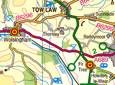
On Sunday, 2nd October, the Stockton Rambling Club will have three walks in the Weardale area of County Durham. All walks will finish in Wolsingham {NZ 075 372} - see the following map.

Crown Copyright (2011). All rights reserved. Licence No. 100046831.
Produced using Anquet Maps.
Produced using Anquet Maps.
The A-walk will start at Hamsterley {NZ 120 310} and will take in Bedburn Old Hall, Neighbour Moor and Brown Law.
The B-walk will also commence at Hamsterley and will visit Howlee Bridge, Doctor's Gate and Towdy Potts.
The C-walk will set off from High Etherley {NZ 164 281} and will pass through Park House, Shipley Moss and Bradley Cottage.
This is a Route 3 coach pick up (Acklam: 9.00 am, Stockton: 9.15 am and Billingham: 9.30 am).
Labels: Sunday Walking to Wolsingham
posted by philbee @ 12:04
0 Comments